Ride.
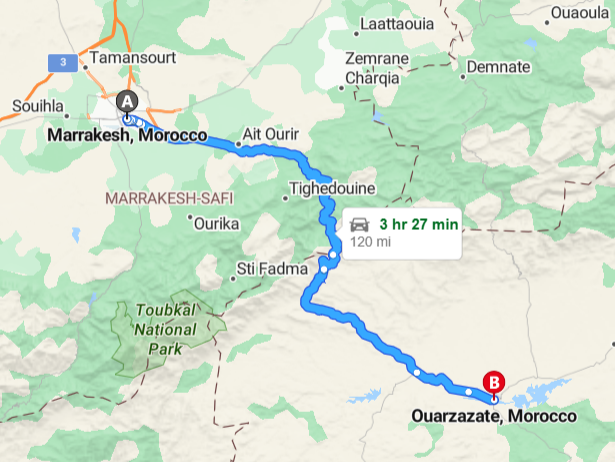
Tizi n’Tichka, Morocco. Marrakesh to Ouarzazate
- Miles: 120
- Start: Marrakesh
- End: Ouarzazate
- Time: 3 hours 30 minutes, allow up to 6 hours
- Suitability: adventure, tourer, sports, A2 or above*
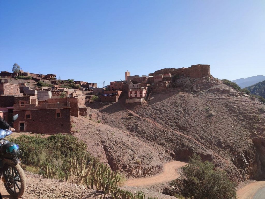
Tizi n’Tichka is a mountain pass in Morocco, linking the south-east of Marrakesh to the city of Ouarzazate through the High Atlas mountains.
It lies above the great Marrakesh plains, and is a gateway to the Sahara desert.
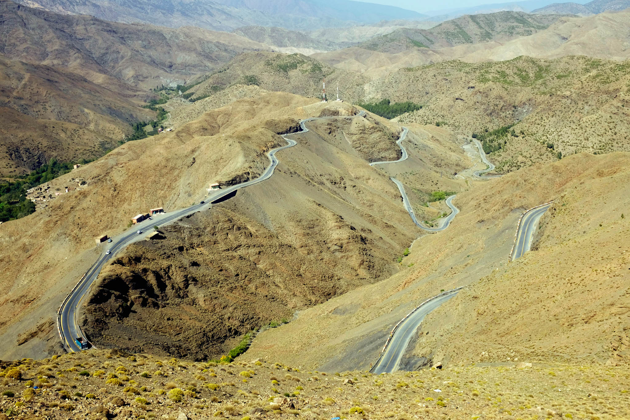
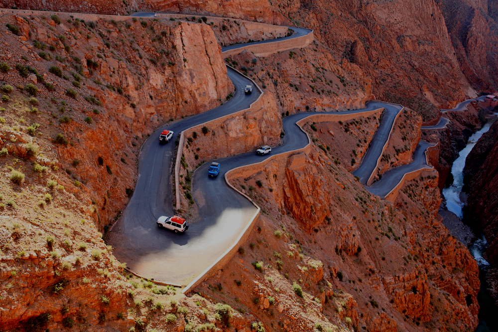
A road, winding and occasionally best not to observe too closely, is often described as one of the nation’s most dramatic and-raising. Tichka, meaning “it’s difficult,” aptly describes this path due to its numerous switchbacks. The road is merely 1-/2 lanes wide, with scarce crash barriers and many precipitous drops, featuring over100 turns. During the, the road generally good condition with some sections recently upgraded. Interestingly, upgrades are done in chunks, so may alternate between the old road and the newly sealed. There is considerable wind, and the road be occasionally bumpy.
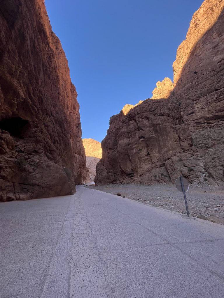
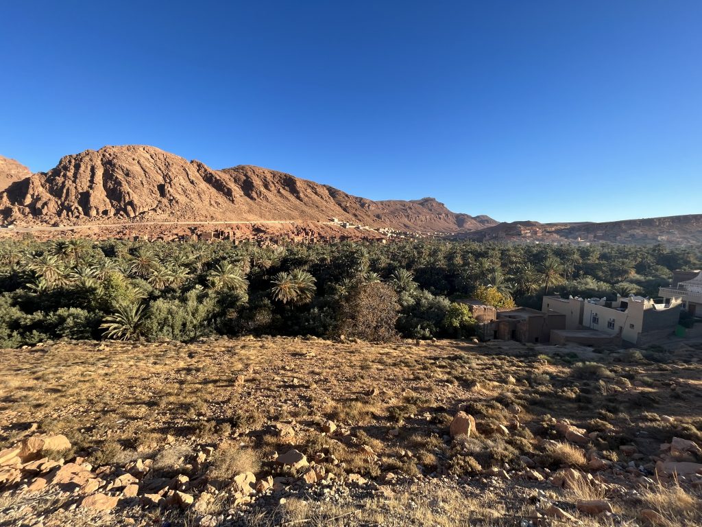
This high mountain road offers breathtaking views of the Atlas at everyback and hairpin turn. At the summit, visitors will be treated to stunning vistas of the surrounding landscapes. As the road descends towards Ouarzazate, travelers can marvel at the pre-Sahara regions that lie and motionless, alongside the peaks of the majestic Mountains. The most famous route through the Atlas leads from the vast plains surrounding the city of Marrakech to the pass which is blocked by snow in the winter and becomes impable. The road then continues past the beautiful kass (clay medieval fortresses) to Ouarzazate, gateway to the valley of the river Draa and the Sahara Desert. views, the villages, and the time spent on the T n’Tichka Pass provide a truly unique experience. Travelers are encouraged to embark on this journey of history, wonder, amazement.
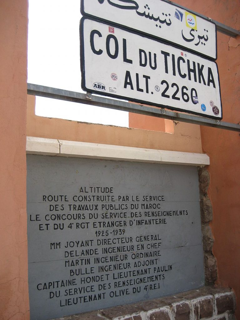
From November through March snow falls on the, though it can remain warm throughout the year due to the strong sun. It long been believed that the pass reaches an elevation of 2,260 meters (7,415 feet) above sea level as indicated by a sign at the top of the pass. However that has been disproven and according to Google Earth the highest altitude of the pass is 2,207 metres (7,241 ft).
It is the highest major mountain pass in North Africa. The road was constructed along the old caravan trail by the French military in 1936 and is now part of National Route 9 (formerly Route P-31).
*We are not saying that its not possible on a 125cc or even a 50cc, however we would not recommend it. Locals use 125cc’s in their local towns only and don’t venture much outside of them