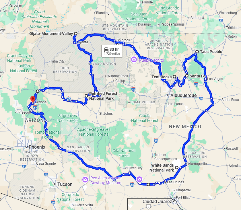
Tour.
New Mexico and Arizona.
- Miles: 1729
- Start: anywhere on route
- End: anywhere on route
- Time: 1 to 2 weeks
- Suitability: adventure, cruiser, tourer
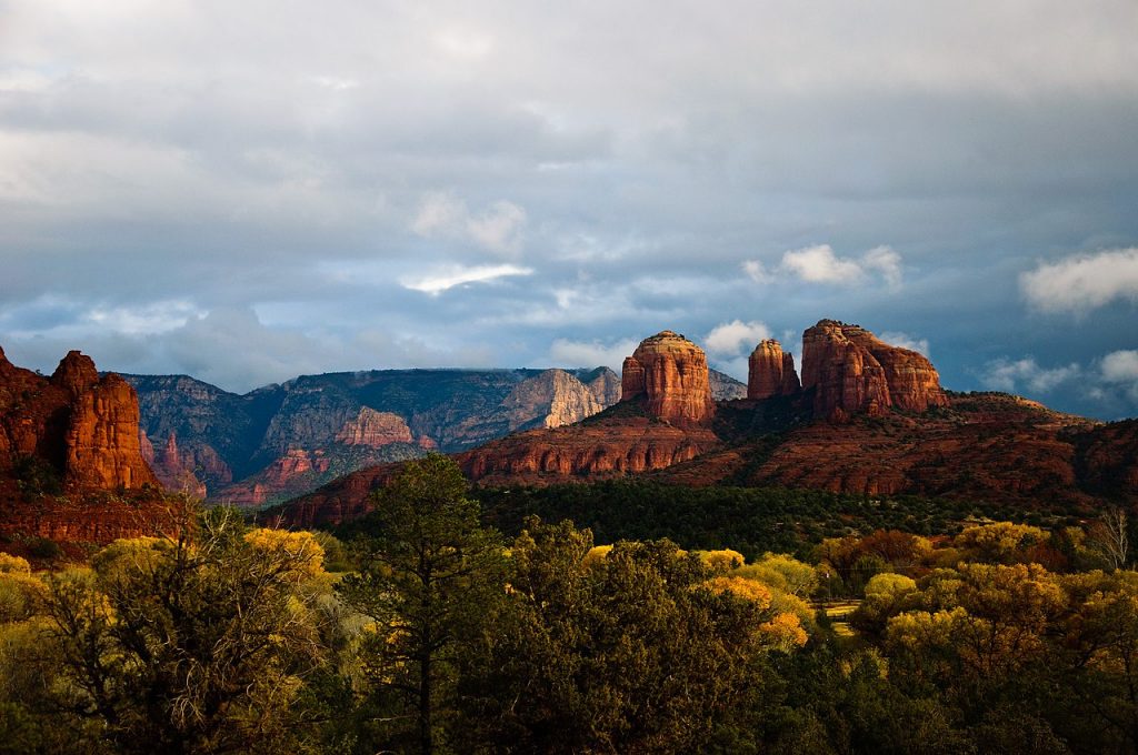
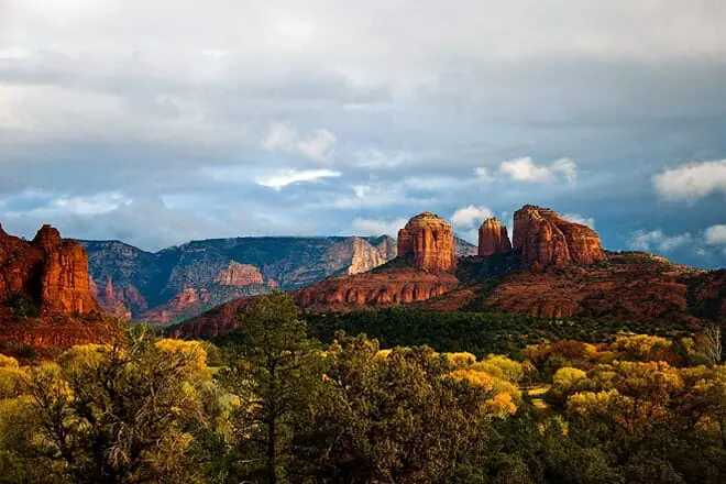
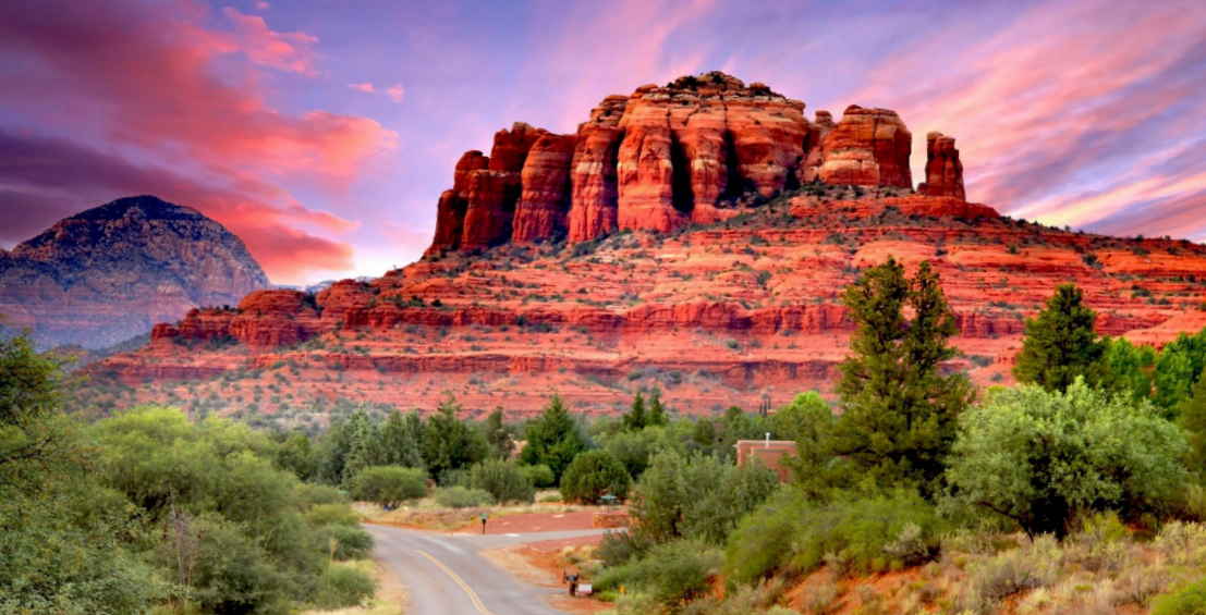
Red Rock State Park is a state park of Arizona, United States, featuring a red sandstone canyon outside the city of Sedona. The main mission of this day-use park is the preservation of the riparian habitat along Oak Creek. Red Rock State Park serves as an environmental education facility for the public and for school or private groups, and provides limited passive recreational opportunities
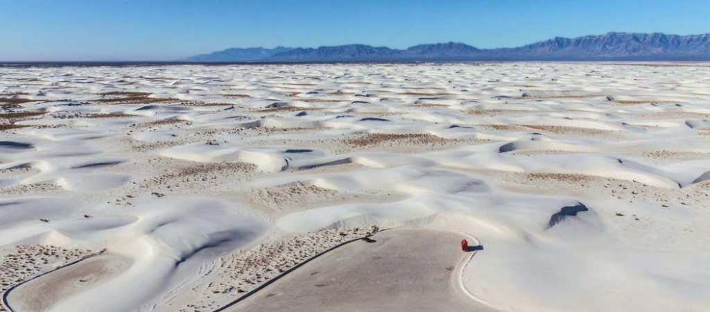
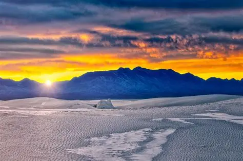
White Sands National Park is a national park of the United States located in New Mexico and completely surrounded by White Sands Missile Range. The park covers 145,762 acres (227.8 sq mi; 589.9 km2) in the Tularosa Basin, including the southern 41% of a 275 sq mi (710 km2) field of white sand dunes composed of gypsum crystals. This gypsum dunefield is the largest of its kind on Earth,[7] with a depth of about 30 feet (9.1 m), dunes as tall as 60 feet (18 m), and about 4.5 billion short tons (4.1 billion metric tons) of gypsum sand.
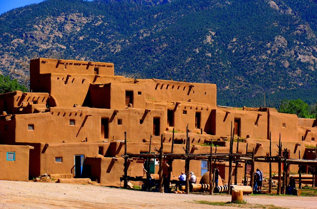
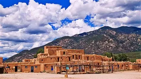
Taos Pueblo (or Pueblo de Taos) is an ancient pueblo belonging to a Taos-speaking (Tiwa) Native American tribe of Puebloan people. It lies about 1 mile (1.6 km) north of the modern city of Taos, New Mexico. The pueblos are one of the oldest continuously inhabited communities in the United States. Taos Pueblo has been designated a UNESCO World Heritage Site.
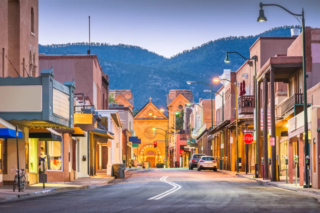
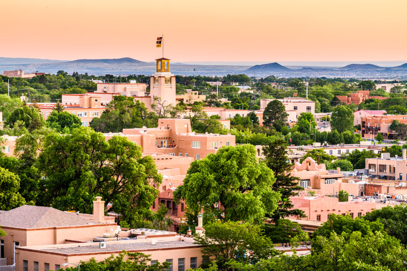
Santa Fe is the capital city of the U.S. state of New Mexico. It is the fourth-most populous city in the state. The greater Albuquerque–Santa Fe–Los Alamos combined statistical area includes eight counties in north-central New Mexico with 1.16 million residents. The county seat of Santa Fe County, Santa Fe is situated at the foothills of the Sangre de Cristo Mountains at the highest altitude of any U.S. state capital, with an elevation of 6,998 feet (2,133 m).
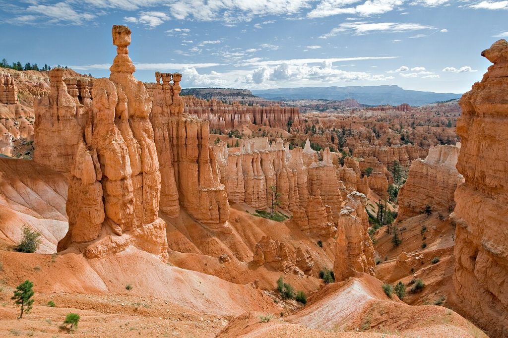
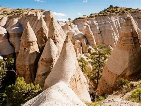
Tent Rocks (hoodoo) is a tall, thin spire of rock formed by erosion. Hoodoos typically consist of relatively soft rock topped by harder, less easily eroded stone that protects each column from the elements. They generally form within sedimentary rock and volcanic rock formations.
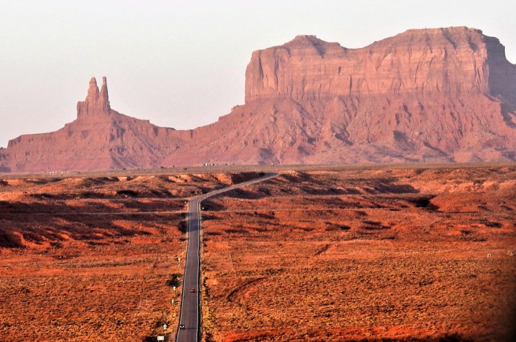
Oljato-Monument Valley is a census-designated place (CDP) in Navajo County, Arizona, United States. The population was 154 at the 2010 census.
According to the United States Census Bureau, the CDP has a total area of 12.5 square miles (32.4 km2), all land.
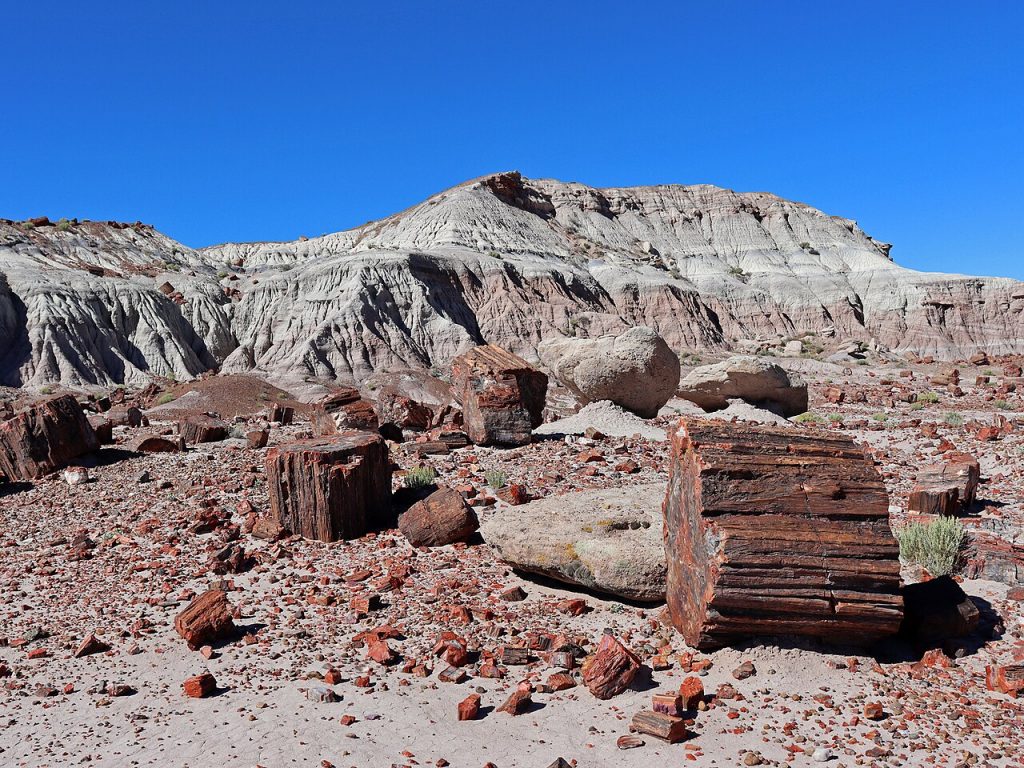
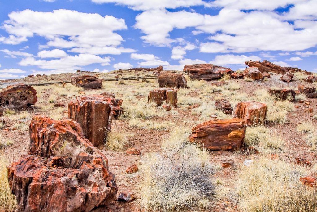
Petrified Forest National Park is a national park of the United States in Navajo and Apache counties in northeastern Arizona. Named for its large deposits of petrified wood, the park covers about 346 square miles (900 square kilometers), encompassing semi-desert shrub steppe as well as highly eroded and colorful badlands.