Ride.
Chapman’s Peak Drive is part of the route of two of South Africa’s biggest mass-participation races, the Cape Argus Cycle Race and the Two Oceans Marathon.

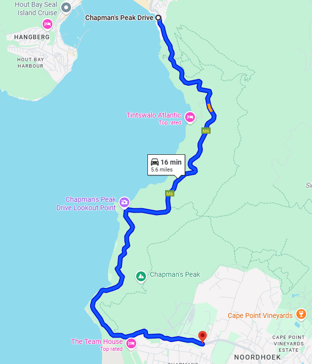
- Miles: 6
- Start: Noordhoek
- End: Hout Bay
- Time: 15 mins to 1 hour
- Suitability: any A2 and above
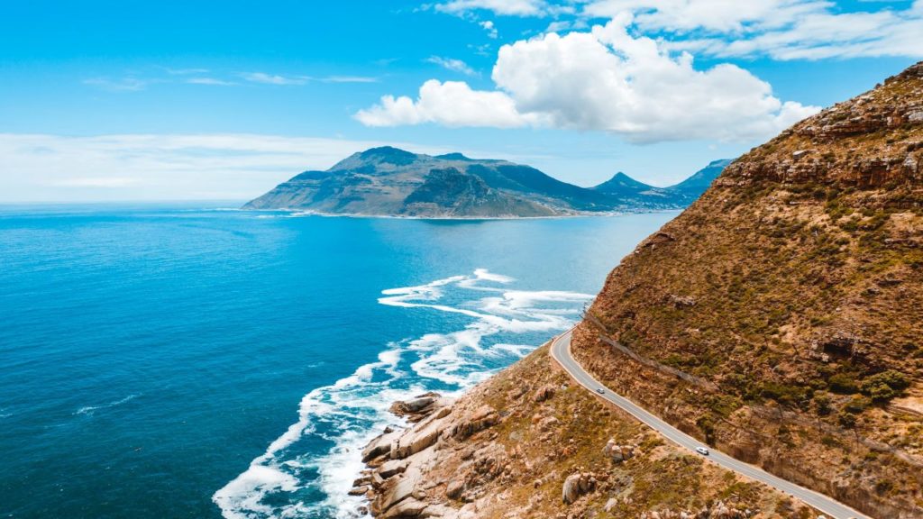
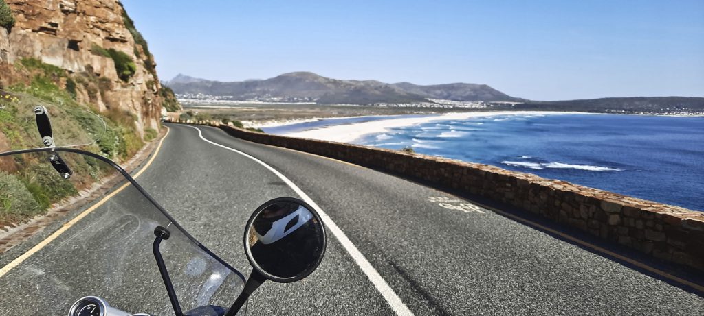
Chapman’s Peak Drive is a short but extremely picturesque route along the coast between Cape Town city and the South Cape Peninsula. This is one of the most beautiful roads in the world. If you ever visit Cape Town, don’t miss it!
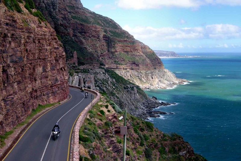
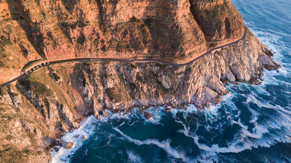
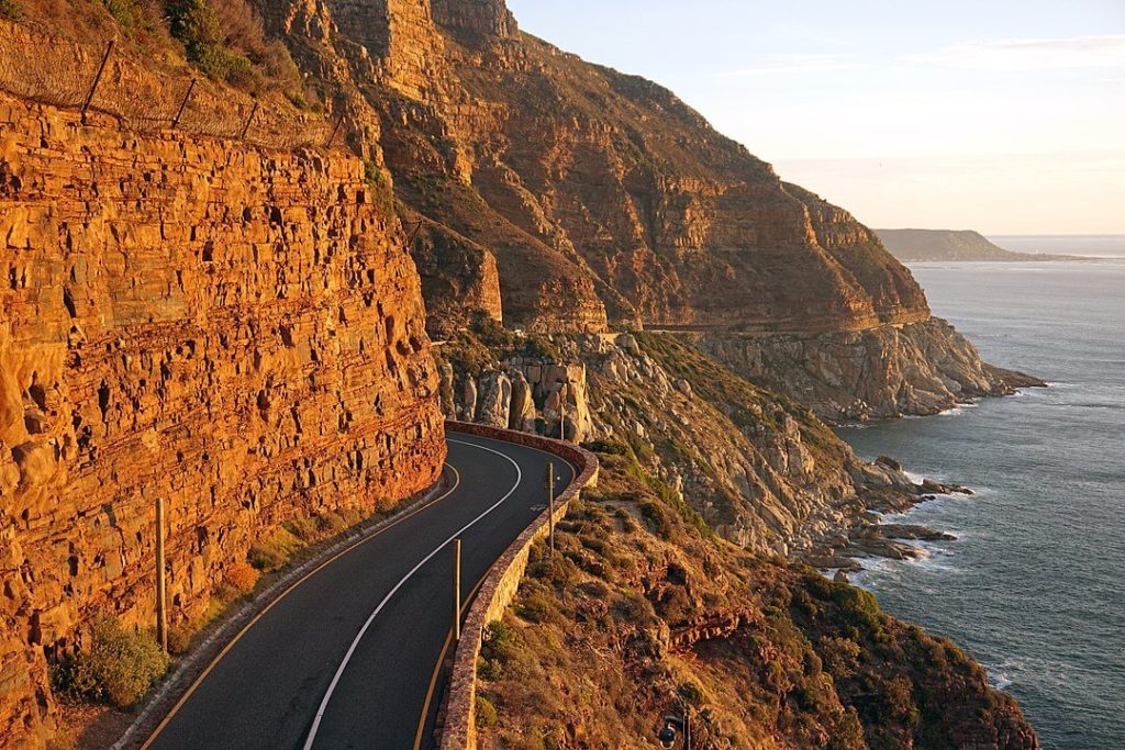
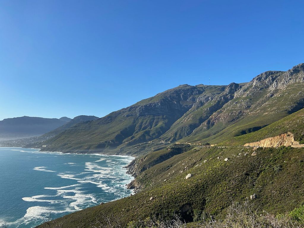
Chapman’s Peak is a mountain on the western side of the Cape Peninsula, between Hout Bay and Noordhoek in Cape Town, South Africa. The western flank of the mountain falls sharply for hundreds of metres into the Atlantic Ocean, and a road, known as Chapman’s Peak Drive, hugs the near-vertical face of the mountain, linking Hout Bay to Noordhoek. Tourists and locals often stop at viewpoints along this road, which offer views of Hout Bay, The Sentinel peak and surrounds, as well as over Noordhoek Beach.
Chapman’s Peak is named after John Chapman, the pilot of an English ship becalmed in today’s Hout Bay in 1607. The skipper sent his pilot ashore to find provisions, and the name was recorded as Chapman’s Chaunce.
Chapman’s Peak Drive was hacked out of the face of the mountain between 1915 and 1922, and at the time was regarded as a major feat of engineering. The road was closed in the 1990s, after a rockfall caused a death and a subsequent lawsuit, and subsequently reopened after being re-engineered to protect motorists from falling rocks. It was reopened in 2005 as a toll road, part of the M6. The road was again closed for a number of months beginning on 19 June 2008 “as a result of risk areas identified on the mountain above the road”.
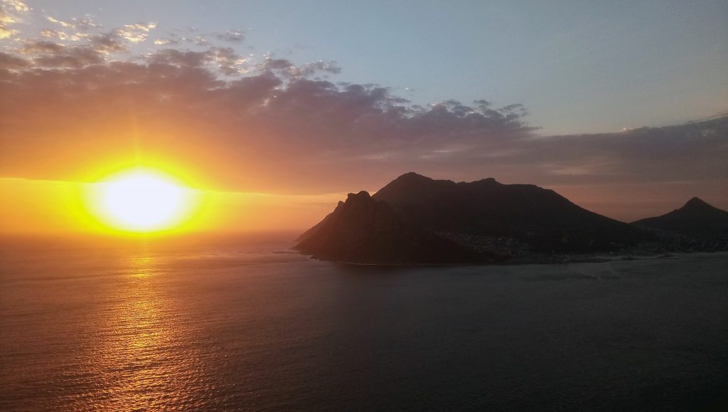
The best time to drive this toll road is at sunset and it’s best to go in the direction of Cape Town city.
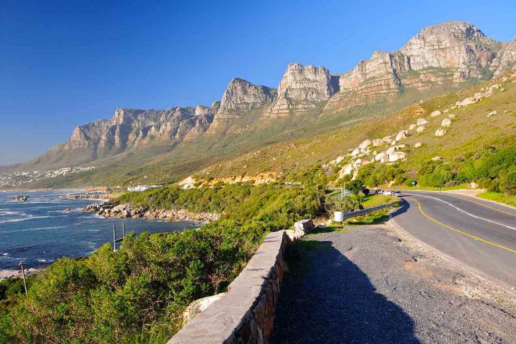
If you continue along the coast, you will pass another stunning stretch of road, the so-called Twelve Apostles (Victoria Rd just before Camps Bay).