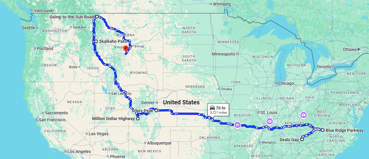
Tour.
Risky roads that push the limits.
- Miles: 3721
- Start: Deals Gap, Tennessee
- End: Beartooth Highway, Wyoming
- Time: 2 to 3 weeks
- Suitability: adventure, cruiser, tourer
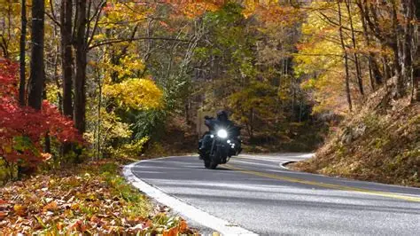
Deals Gap (el. 1,988 ft (606 m)) is a mountain pass along the North Carolina–Tennessee state line, bordering the Great Smoky Mountains National Park and near the Little Tennessee River. At 0.7 miles (1.1 km) south of the gap is the unincorporated community that shares the same name, located at the intersection of US 129 and NC 28. The area is popular with motorcycle and sports car enthusiasts, who cross the gap into Tennessee to drive along the “Tail of the Dragon”, famous for its 318 curves in 11 miles (18 km).
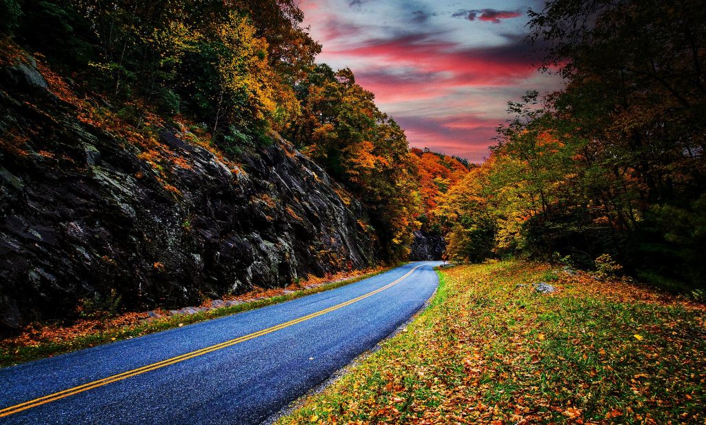
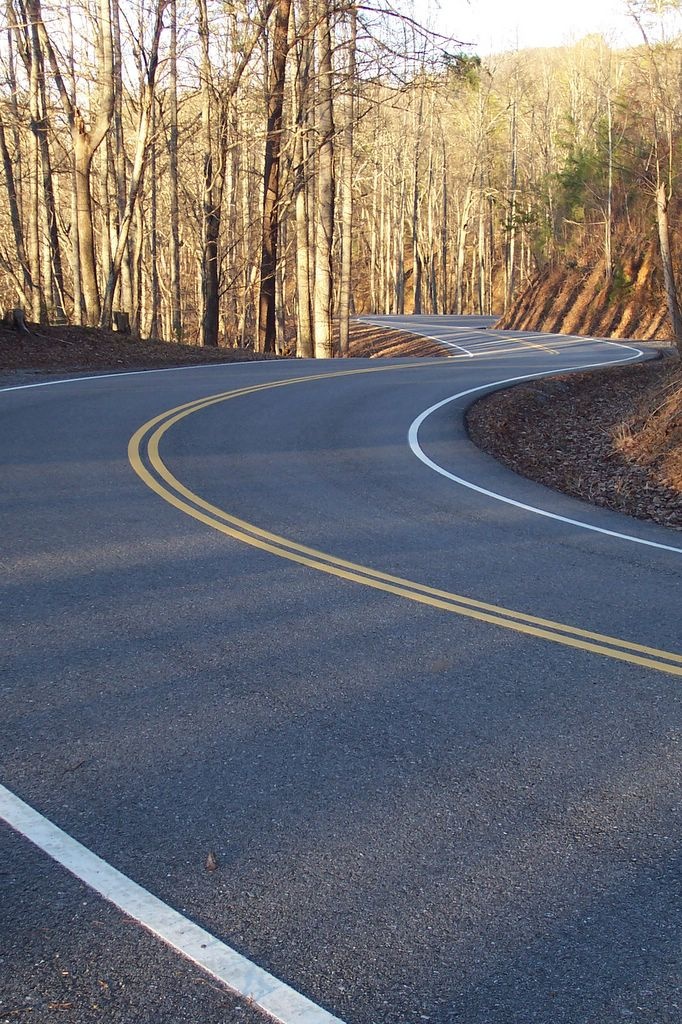
The Blue Ridge Parkway is a National Parkway and All-American Road in the United States, noted for its scenic beauty. The parkway, which is the longest linear park in the U.S., runs for 469 miles (755 km) through 29 counties in Virginia and North Carolina, linking Shenandoah National Park to Great Smoky Mountains National Park. It runs mostly along the spine of the Blue Ridge, a major mountain chain that is part of the Appalachian Mountains.
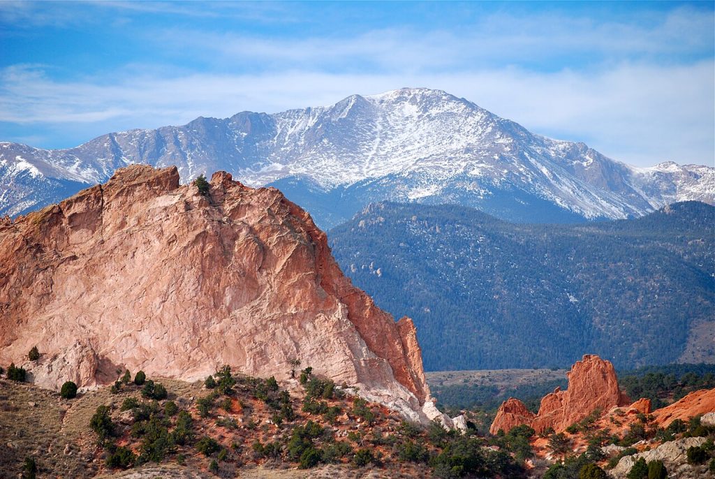
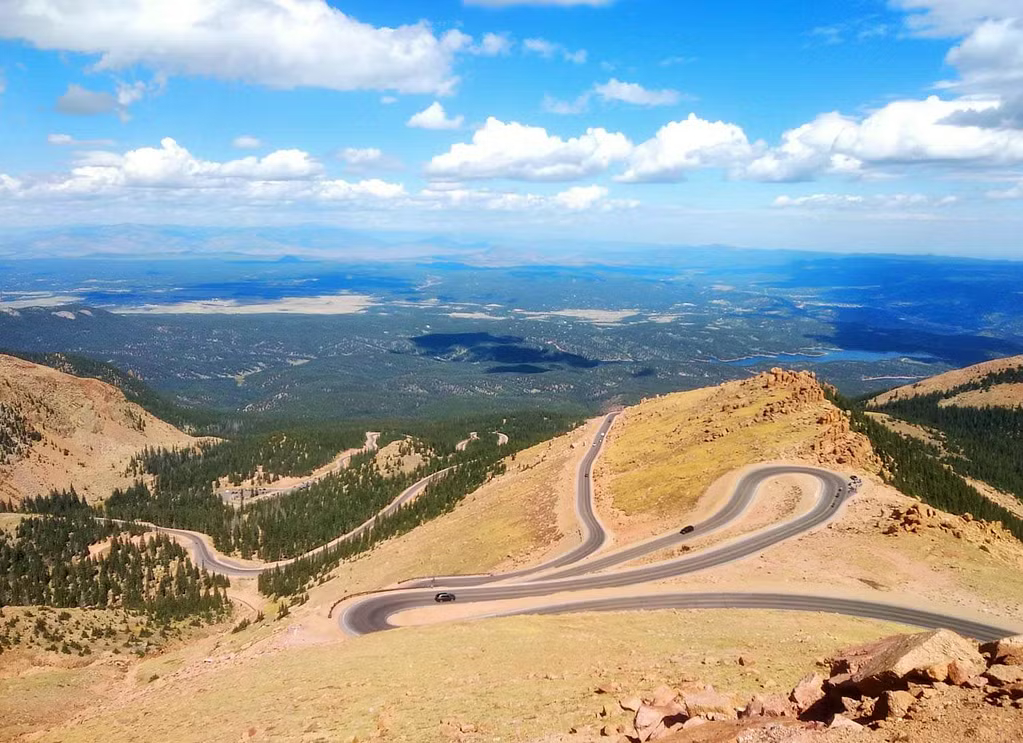
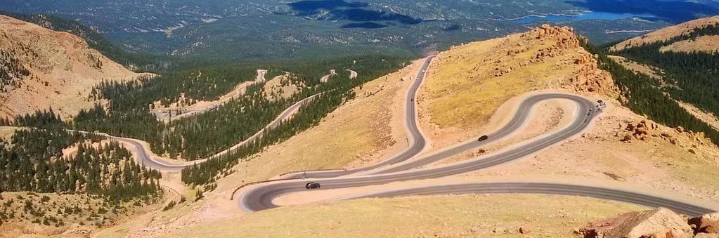
Pikes Peak is the highest summit of the southern Front Range of the Rocky Mountains in North America. The ultra-prominent 14,107-foot (4,299.83 m) fourteener is located in Pike National Forest, 12 miles (19 km) west of downtown Colorado Springs, Colorado. The town of Manitou Springs lies at its base.
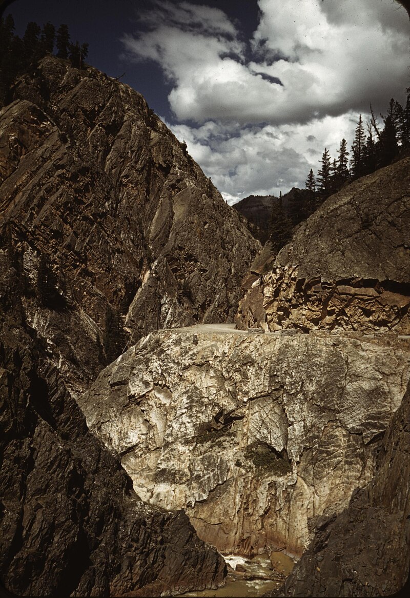
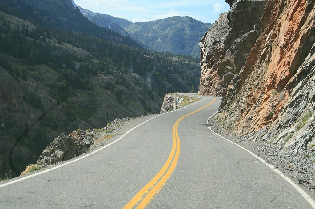
The Million Dollar Highway stretches for about 25 miles (40 km) in western Colorado and follows the route of U.S. 550 between Silverton and Ouray, Colorado. It is part of the San Juan Skyway Scenic Byway. Between Durango and Silverton the Skyway loosely parallels the Durango and Silverton Narrow Gauge Railroad.
Although the entire stretch has been called the Million Dollar Highway, it is actually just the twelve miles (19 km) south of Ouray through the Uncompahgre Gorge to the summit of Red Mountain Pass which gives the highway its name. This stretch through the gorge is challenging and potentially hazardous to drive; it is characterized by steep cliffs, narrow lanes, and a lack of guardrails; the ascent of Red Mountain Pass is marked with a number of hairpin curves used to gain elevation, narrow lanes for traffic—many cut directly into the sides of mountains.
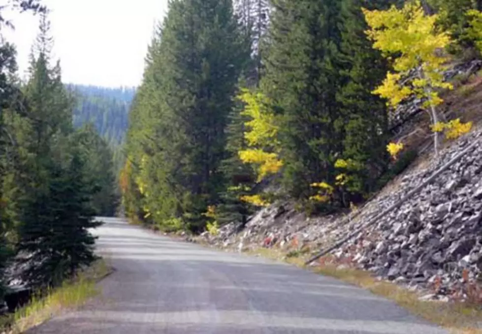
The Skalkaho Pass, 7,258 feet (2,212 m) above sea level, is a pass in the Sapphire Mountains in southwest Montana traversed by Montana Highway 38.
The road over the pass connects the towns of Hamilton in the Bitterroot Valley and Philipsburg in Flint Creek Valley and remains the only direct route between these two important agricultural areas. Originally an Indian route, Highway 38 was built in 1924 to link mountainous mining areas with the agricultural settlements in the valleys. The route is closed during winter due to heavy snowfall.
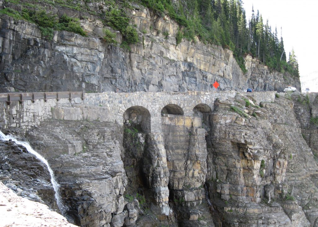
Going-to-the-Sun Road is a scenic mountain road in the Rocky Mountains of the western United States, in Glacier National Park in Montana. The Sun Road, as it is sometimes abbreviated in National Park Service documents, is the only road that traverses the park, crossing the Continental Divide through Logan Pass at an elevation of 6,646 feet (2,026 m), which is the highest point on the road.
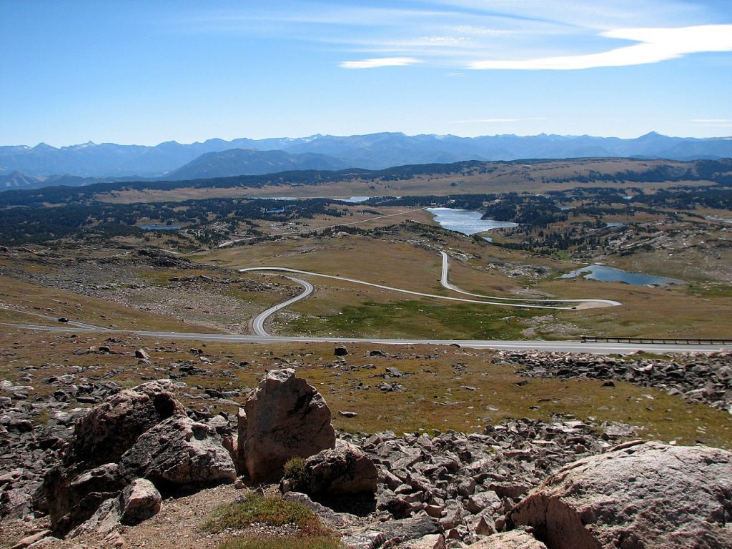
The Beartooth Highway is an All-American Road in the western United States on a section of U.S. Route 212 in Montana and Wyoming between Red Lodge and the Northeast entrance of Yellowstone National Park. It crests at Beartooth Pass in Wyoming at 10,947 feet (3,337 m) above sea level, and was called “the most beautiful drive in America”.