Ride.
Lands End to John O Groats.
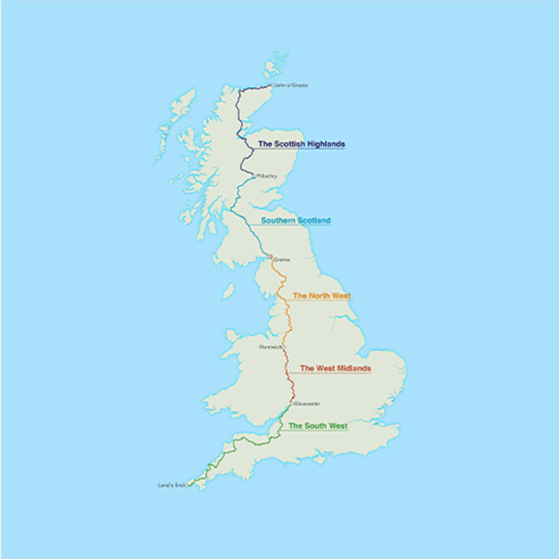
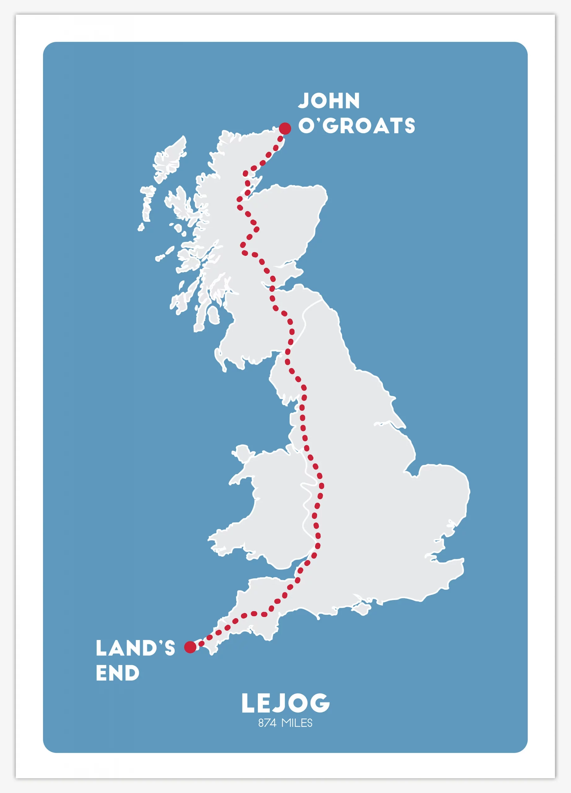
- Miles: 874
- Start: Lands End or John O Groats
- End: John O Groats or Lands End
- Time:
- Suitability: A2 and above
Land’s End to John o’ Groats is the traversal of the length of the island of Great Britain between two extremities, in the southwest and the northeast.
Lands End – O.S. Grid Reference of the road end is SW342250, Postcode TR19 7AA.
John O’ Groats – O.S. Grid Reference ND380735, Postcode KW1 4YR.
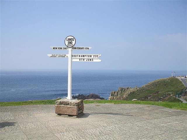
Land’s End is the traditionally acknowledged extreme western point of mainland England. It is in western Cornwall at the end of the Penwith peninsula. In fact it, or strictly speaking Dr Syntax’s Head, SW341253, a few hundred yards NW of the road end, is mainland England’s most westerly point. The most southerly point is Lizard Point, about 9 miles (14 km) further south. Land’s End is sometimes reckoned incorrectly as mainland Great Britain’s most southwesterly point. This accolade belongs to Gwennap Head, SW365215, which is at least 2 miles (3.2 km) further south than Dr Syntax’s Head but only about 1.5 miles (2.4 km) less west.
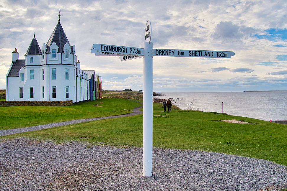
John o’ Groats is the traditionally acknowledged extreme northern point of mainland Scotland, in northeastern Caithness. The actual northernmost point is Dunnet Head about 2 miles (3 km) further north. The point that is farthest by road from Land’s End is Duncansby Head, about 2 miles (3 km) east of John o’ Groats. Duncansby Head is also the most northeasterly point of the British mainland.